
- Joined
- Aug 8, 2008
- Messages
- 6,070
- Points
- 83
https://mil.news.sina.com.cn/2019-05-18/doc-ihvhiqax9499279.shtml
俄建议修管道往新疆送淡水:助中国解决北方缺水问题
2019年05月18日 07:33 环球网
426
俄国家杜马国际事务委员会副主席阿列克谢·切帕日前致函俄罗斯政府要求后者批准从俄阿尔泰边疆区经哈萨克斯坦向中国新疆输送淡水管道的建设项目。他认为,该项目不仅可以解决中国北方缺水问题,而且有助于俄当地发展。但也有俄专家称,该项目的实施存在困难。
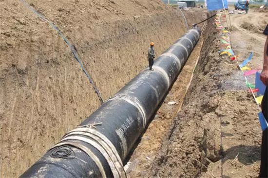
输水管道资料图
报道称,俄政府部门已将切帕的信函副本发送给政府有关部门及阿尔泰边疆区政府进行研究。上个月,俄国家杜马举行了“俄罗斯、哈萨克斯坦和中国经济一体化:前景与战略项目”圆桌会议,讨论了建设该输水管道问题。与会者建议俄罗斯与中哈两国在政府层面上讨论有关项目,并成立跨政府间工作小组。
据了解,阿尔泰地区每年春季都遭受水灾,该地区在汛期的水资源富余量为7000万至1亿立方米/年。去年该地区发生了35年来最大的洪水,造成巨大损失。一些圆桌会议与会者称,通过高科技管道系统从阿尔泰地区向中国输出多余的水有利于地区供水系统现代化建设,减少洪灾损失,并获得现代化农业技术。另外,该项目将吸引许多俄罗斯公司参与,可促进国家经济发展。切帕认为,这样的项目可能比石油贸易更让人感兴趣。
不过也有专家对这一项目持怀疑立场,认为中国的缺水问题是相对的,中国实施南水北调比从俄输水更便宜。此外,如此大规模的项目不仅需要进行严格的环境影响评估,还需要大量的资金进行管道维护,这将增加建设成本,因此,该项目从经济上考虑不可行。
俄媒报道称,实际上,上述输水管道项目在去年举行的中国-俄罗斯-东欧-中亚交流协会上就已被提出。据称,与会者建议俄政府建设一条从俄罗斯经哈萨克斯坦至中国西部、总长度为1200至1500公里的输水管道。专家估计,整个项目预计总投资可达880亿美元。
Https://mil.news.sina.com.cn/2019-05-18/doc-ihvhiqax9499279.shtml
Russia proposes to repair pipelines to send fresh water to Xinjiang: help China solve the problem of water shortage in the north
May 18, 2019 07:33 World Wide Web
426
Alexei Chepa, vice chairman of the Russian State Duma International Affairs Committee, sent a letter to the Russian government asking the latter to approve the construction of a freshwater pipeline from Russia's Altai Territory to Kazakhstan via China. He believes that the project can not only solve the problem of water shortage in northern China, but also contribute to the local development of Russia. However, some Russian experts said that the implementation of the project is difficult.
Water pipeline data map
According to the report, the Russian government has sent a copy of Chepa’s letter to the relevant government departments and the Altai Territory Government for research. Last month, the Russian State Duma held a round table on "The Economic Integration of Russia, Kazakhstan and China: Prospects and Strategic Projects" to discuss the construction of the water pipeline. Participants suggested that Russia and China and Kazakhstan discuss relevant projects at the government level and establish an intergovernmental working group.
It is understood that the Altai region suffers from floods every spring, and the water resources in the flood season in the region are between 70 million and 100 million cubic meters per year. The region’s largest flood in 35 years last year caused huge losses. Some roundtable participants said that the use of high-tech pipeline systems to export excess water from the Altai region to China is conducive to the modernization of regional water supply systems, reducing flood damage and acquiring modern agricultural technologies. In addition, the project will attract the participation of many Russian companies to promote national economic development. Chepa believes that such a project may be more interesting than oil trade.
However, some experts have doubts about this project and believe that China's water shortage problem is relative. China's implementation of the South-to-North Water Transfer is cheaper than transferring water from Russia. In addition, such a large-scale project requires not only a rigorous environmental impact assessment, but also a large amount of funds for pipeline maintenance, which will increase construction costs, so the project is not economically feasible.
Russian media reported that, in fact, the above-mentioned water pipeline project was proposed at the China-Russia-Eastern Europe-Central Asia Exchange Association held last year. The participants allegedly suggested that the Russian government build a water pipeline from Russia to Kazakhstan to the west of China with a total length of 1,200 to 1,500 kilometers. Experts estimate that the total investment of the entire project is expected to reach $88 billion.
俄建议修管道往新疆送淡水:助中国解决北方缺水问题
2019年05月18日 07:33 环球网
426
俄国家杜马国际事务委员会副主席阿列克谢·切帕日前致函俄罗斯政府要求后者批准从俄阿尔泰边疆区经哈萨克斯坦向中国新疆输送淡水管道的建设项目。他认为,该项目不仅可以解决中国北方缺水问题,而且有助于俄当地发展。但也有俄专家称,该项目的实施存在困难。
输水管道资料图
报道称,俄政府部门已将切帕的信函副本发送给政府有关部门及阿尔泰边疆区政府进行研究。上个月,俄国家杜马举行了“俄罗斯、哈萨克斯坦和中国经济一体化:前景与战略项目”圆桌会议,讨论了建设该输水管道问题。与会者建议俄罗斯与中哈两国在政府层面上讨论有关项目,并成立跨政府间工作小组。
据了解,阿尔泰地区每年春季都遭受水灾,该地区在汛期的水资源富余量为7000万至1亿立方米/年。去年该地区发生了35年来最大的洪水,造成巨大损失。一些圆桌会议与会者称,通过高科技管道系统从阿尔泰地区向中国输出多余的水有利于地区供水系统现代化建设,减少洪灾损失,并获得现代化农业技术。另外,该项目将吸引许多俄罗斯公司参与,可促进国家经济发展。切帕认为,这样的项目可能比石油贸易更让人感兴趣。
不过也有专家对这一项目持怀疑立场,认为中国的缺水问题是相对的,中国实施南水北调比从俄输水更便宜。此外,如此大规模的项目不仅需要进行严格的环境影响评估,还需要大量的资金进行管道维护,这将增加建设成本,因此,该项目从经济上考虑不可行。
俄媒报道称,实际上,上述输水管道项目在去年举行的中国-俄罗斯-东欧-中亚交流协会上就已被提出。据称,与会者建议俄政府建设一条从俄罗斯经哈萨克斯坦至中国西部、总长度为1200至1500公里的输水管道。专家估计,整个项目预计总投资可达880亿美元。
Https://mil.news.sina.com.cn/2019-05-18/doc-ihvhiqax9499279.shtml
Russia proposes to repair pipelines to send fresh water to Xinjiang: help China solve the problem of water shortage in the north
May 18, 2019 07:33 World Wide Web
426
Alexei Chepa, vice chairman of the Russian State Duma International Affairs Committee, sent a letter to the Russian government asking the latter to approve the construction of a freshwater pipeline from Russia's Altai Territory to Kazakhstan via China. He believes that the project can not only solve the problem of water shortage in northern China, but also contribute to the local development of Russia. However, some Russian experts said that the implementation of the project is difficult.
Water pipeline data map
According to the report, the Russian government has sent a copy of Chepa’s letter to the relevant government departments and the Altai Territory Government for research. Last month, the Russian State Duma held a round table on "The Economic Integration of Russia, Kazakhstan and China: Prospects and Strategic Projects" to discuss the construction of the water pipeline. Participants suggested that Russia and China and Kazakhstan discuss relevant projects at the government level and establish an intergovernmental working group.
It is understood that the Altai region suffers from floods every spring, and the water resources in the flood season in the region are between 70 million and 100 million cubic meters per year. The region’s largest flood in 35 years last year caused huge losses. Some roundtable participants said that the use of high-tech pipeline systems to export excess water from the Altai region to China is conducive to the modernization of regional water supply systems, reducing flood damage and acquiring modern agricultural technologies. In addition, the project will attract the participation of many Russian companies to promote national economic development. Chepa believes that such a project may be more interesting than oil trade.
However, some experts have doubts about this project and believe that China's water shortage problem is relative. China's implementation of the South-to-North Water Transfer is cheaper than transferring water from Russia. In addition, such a large-scale project requires not only a rigorous environmental impact assessment, but also a large amount of funds for pipeline maintenance, which will increase construction costs, so the project is not economically feasible.
Russian media reported that, in fact, the above-mentioned water pipeline project was proposed at the China-Russia-Eastern Europe-Central Asia Exchange Association held last year. The participants allegedly suggested that the Russian government build a water pipeline from Russia to Kazakhstan to the west of China with a total length of 1,200 to 1,500 kilometers. Experts estimate that the total investment of the entire project is expected to reach $88 billion.


