
- Joined
- Nov 29, 2016
- Messages
- 5,674
- Points
- 63
https://tw.news.yahoo.com/格陵蘭冰層單日消失20億噸-6月中旬急遽融冰極為罕見-230100393.html
格陵蘭冰層單日消失20億噸 6月中旬急遽融冰極為罕見
上報
3.5k 人追蹤
陳品潔
2019年6月16日 上午7:01
格陵蘭島13日當天冰原急遽融化,據統計約有40%、且總量逾20億噸的冰雪融化。
格陵蘭的「融冰季節」主要發生6月到8月,但多數的融化集中在7月。根據《美國有線電視新聞台》(CNN)報導,在6月中旬融化面積激增「極其罕見」。2019年夏天初即大幅融化的跡象顯示,格陵蘭的融冰量可能將再創歷史新紀錄。
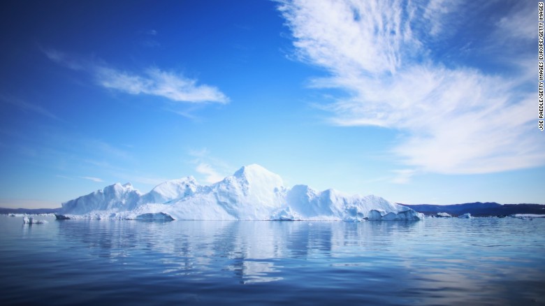
格陵蘭為一座面積216.6萬平方公里、世界上最大的島嶼,其中超過八成皆被冰雪覆蓋。
Greenland is having a normal one https://t.co/zKgG7rGhOZ pic.twitter.com/87XGxTCTgK
— Brian L Kahn (@blkahn) 2019年6月14日
— Brian L Kahn (@blkahn) 2019年6月14日
Yesterday (13th June), we calculate #Greenland #icesheet lost more than 2 Gt (2 km³") of ice,, melt was widespread but didn't quite get to #SummitCamp which was just below 0°C
of ice,, melt was widespread but didn't quite get to #SummitCamp which was just below 0°C
The high melt is unusual so early in the season but not unprecedentedhttps://t.co/Ftg0fkC7AK pic.twitter.com/Y4jQ1FoFRZ
— Greenland (@greenlandicesmb) 2019年6月14日
大型融冰期將至 海平面高度受重大影響 of ice,, melt was widespread but didn't quite get to #SummitCamp which was just below 0°CThe high melt is unusual so early in the season but not unprecedentedhttps://t.co/Ftg0fkC7AK pic.twitter.com/Y4jQ1FoFRZ
— Greenland (@greenlandicesmb) 2019年6月14日
喬治亞大學研究格陵蘭氣候的專家莫特(Thomas Mote)指出,所有跡象似乎指向大型的「融冰季節」即將發生,可能將導致海平面上升等重大影響。
莫特表示:「此與在2012年6月觀測到的峰值相當」。2012年格陵蘭的融化創下紀錄,冰蓋在7月8日起融化面積從40%左右驟升至超過97%,是美國國家航空暨太空總署(NASA)30多年來觀測到最大規模的融冰。
Arctic melt goes into overdrive across land and sea, including Greenland. https://t.co/viM8yvlLKT Steffen Olsen pic.twitter.com/TMScEXeKtP
— Andrew Freedman (@afreedma) 2019年6月14日
— Andrew Freedman (@afreedma) 2019年6月14日
莫特表示,融化突然飆升雖「不尋常,但非前所未見」,在2007年、2010年,及2012年皆出現過類似現象;在1990年以前,則從未看過這樣的情形。
融冰季節提早
丹麥及格陵蘭地質調查局(Geological Survey of Denmark and Greenland)的氣候學家鮑克斯(Jason Box)在5月即預言,2019年格陵蘭將面臨嚴重的融冰,甚至將超越2012年的歷史紀錄。
鮑克斯指出,2019年4月的融冰開始異常,且「融冰季節」比平均「提前約3周,甚至比創紀錄的2012年還要早發生」。
大西洋溫暖空氣、阻塞脊致融冰
莫特分析冰蓋突然融化的原因,是由於高壓力脊(high pressure ridge)將大西洋的溫暖潮濕空氣帶入格陵蘭,從而致使冰層溫度升高。
在過去的一兩周中,另一波高氣壓鋒面從美國東部進入時,更強化了高壓力脊(high pressure front)的影響。4月的一些融化現象,是因春季多數時間中,東格陵蘭的阻塞脊(blocking ridge)所致。
Blocking pattern near #Greenland will favor well above average temperatures this week (negative North Atlantic Oscillation (NAO))
---> expect surface melt to accelerate on the ice sheet pic.twitter.com/kbbDtyf647
— Zack Labe (@ZLabe) 2019年6月12日
更多上報內容:---> expect surface melt to accelerate on the ice sheet pic.twitter.com/kbbDtyf647
— Zack Labe (@ZLabe) 2019年6月12日
加州餐飲業開徵1%「氣候變遷稅」 變相漲價反獲老饕佳評
南極洲國王企鵝數量驟降 年度哈雷灣萬隻聚會成絕響
全球暖化加速聖母峰融雪 近300具遺體「現蹤」成登山客路標
https://edition.cnn.com/2019/06/14/us/greenland-sudden-ice-melt-wxc/index.html
Greenland lost 2 billion tons of ice this week, which is very unusual
By Brandon Miller, CNN Meteorologist
Updated 2108 GMT (0508 HKT) June 15, 2019
(CNN)Over 40% of Greenland experienced melting Thursday, with total ice loss estimated to be more than 2 gigatons (equal to 2 billion tons) on just that day alone.
While Greenland is a big island filled with lots of ice, it is highly unusual for that much ice to be lost in the middle of June. The average "melt season" for Greenland runs from June to August, with the bulk of the melting occurring in July.
To visualize how much ice that is, imagine filling the National Mall in Washington with enough ice to reach a point in the sky eight times higher than the Washington Monument (to borrow an analogy Meredith Nettles from Columbia University gave to The Washington Post).
Yesterday (13th June), we calculate #Greenland #icesheet lost more than 2 Gt (2 km³) of ice,, melt was widespread but didn't quite get to #SummitCamp which was just below 0°C
The high melt is unusual so early in the season but not unprecedentedhttps://t.co/Ftg0fkC7AK pic.twitter.com/Y4jQ1FoFRZ
— Greenland (@greenlandicesmb) June 14, 2019
The sudden spike in melting "is unusual, but not unprecedented," according to Thomas Mote, a research scientist at the University of Georgia who studies Greenland's climate.The high melt is unusual so early in the season but not unprecedentedhttps://t.co/Ftg0fkC7AK pic.twitter.com/Y4jQ1FoFRZ
— Greenland (@greenlandicesmb) June 14, 2019
"It is comparable to some spikes we saw in June of 2012," Mote told CNN, referring to the record-setting melt year of 2012 that saw almost the entire ice sheet experience melting for the first time in recorded history.
This much melting this early in the summer could be a bad sign, indicating 2019 could once again set records for the amount of Greenland ice loss.
Mote explained how snow and ice melt off the Greenland ice sheet, especially early in the season, makes it easier to for additional melt to occur later in the summer.
White snow and ice, which is bright and reflects the sun's rays back into space, reduces the amount of heat that is absorbed and helps to keep the ice sheet cold, a process known as "albedo."
"These melt events result in a changed surface albedo," according to Mote, which will allow more of the mid-summer sun's heat to be absorbed into the ice and melt it.
Predictions for a record melt season
Mote says "all signs seem to be pointing to a large melt season," and he is far from the only scientist to think so.
Jason Box, an ice climatologist at the Geological Survey of Denmark and Greenland, predicted in late May that "2019 will be a big melt year for Greenland."
Box pointed out that this year had unusually early-season melt days in April, and the melt season was "happening about three weeks earlier than average, and earlier than the record-setting melt year of 2012."
In addition to the early-season melt, the snow cover is already lower than average in Western Greenland, and combining these factors means "2019 is likely going to be a very big melt year, and even the potential to exceed the record melt year of 2012."
What is causing the sudden melt?
A persistent weather pattern has been setting the stage for the current spike in melting, according to Mote.
"We've had a blocking ridge that has been anchored over East Greenland throughout much of the spring, which led to some melting activity in April -- and that pattern has persisted."
That high pressure ridge pulls up warm, humid air from the Central Atlantic into portions of Greenland,.which leads to warmer temperatures over the ice. The high pressure also prevents precipitation from forming and leads to clear, sunny skies.
Over the past week or two, that high pressure ridge got even stronger as another high pressure front moved in from the eastern United States -- the one that caused the prolonged hot and dry period in the Southeast earlier this month.
Melt periods such as the current one are not unprecedented; Mote noted previous periods in 2012, 2010 and 2007, all major melt years. But he pointed out that until recently, they were unheard of.
"We've seen a sequence of these large melt seasons, starting in 2007, that would have been unprecedented earlier in the record," he said. "We didn't see anything like this prior to the late 1990s.
If these extreme melt seasons are becoming the new normal, it could have significant ramifications around the globe, especially for sea level rise.
"Greenland has been an increasing contributor to global sea level rise over the past two decades," Mote said, "and surface melting and runoff is a large portion of that."
https://www.washingtonpost.com/weat...have-seen-record-june-ice-loss/?noredirect=on
Temperatures leap 40 degrees above normal as the Arctic Ocean and Greenland ice sheet see record June melting
And it may be messing with our weather.

Steffen Olsen, an Arctic researcher with the Danish Meteorological Institute, and dogs set out to retrieve oceanographic moorings and a weather station over meltwater topping sea ice in northwest Greenland on Thursday. (Steffen Olsen)
By Jason Samenow
June 14 at 12:52 PM
Ice is melting in unprecedented ways as summer approaches in the Arctic. In recent days, observations have revealed a record-challenging melt event over the Greenland ice sheet, while the extent of ice over the Arctic Ocean has never been this low in mid-June during the age of weather satellites.
Greenland saw temperatures soar up to 40 degrees above normal Wednesday, while open water exists in places north of Alaska where it seldom, if ever, has in recent times.
It’s “another series of extreme events consistent with the long-term trend of a warming, changing Arctic,” said Zachary Labe, a climate researcher at the University of California at Irvine.
And the abnormal warmth and melting of ice in the Arctic may be messing with our weather.
Greenland ice sheet

Melt extent on the Greenland Ice Sheet between April and October. The recent melt event (indicated by the blue line) appears to be the greatest on record in mid-June. (National Snow and Ice Data Center)
Data from the National Snow and Ice Data Center show that the Greenland ice sheet appears to have witnessed its biggest melt event so early in the season on record this week (although a few other years showed similar mid-June melting).
“The melting is big and early,” said Jason Box, an ice climatologist at the Geological Survey of Denmark and Greenland.

Extent of Greenland ice sheet melting on June 12. (National Snow and Ice Data Center)
Box explained that temperatures over the western Greenland ice sheet have been abnormally high while snow has been well below normal.
Marco Tedesco, an ice researcher at Columbia University, added that it has been unusually warm in east and central Greenland, as well. “This has triggered widespread melting that has reached about 45 percent of the ice sheet,” he wrote in an email.
Normally, melting this widespread over the ice sheet doesn’t occur until midsummer, if even then.
A simulation from the European Centre for Medium-range Weather Forecasting suggested that temperatures over Greenland may have peaked at around 40 degrees above normal on Wednesday.
European model simulation of temperature difference from normal over Greenland on Wednesday. (WeatherBell.com)
A big dome of high pressure has positioned itself over Greenland, resulting in sunny skies and mild temperatures, which have enabled melting. An automated weather station at the top of Greenland’s ice sheet topped freezing on June 12, a very rare event, which last occurred in July 2012.
The @NOAA automatic weather station at Summit, Greenland, suggests air temperature flickered above 0°C at 19:30 LST June 12. https://t.co/Dy0e7uRiRx pic.twitter.com/EpOl2R5dmV
— William Colgan, Ph.D. (@GlacierBytes) June 13, 2019
— William Colgan, Ph.D. (@GlacierBytes) June 13, 2019
2012 is the notorious year in which the Greenland ice sheet witnessed the most melting on record. Those monitoring the ice sheet say melting in 2019 could rival it.
Weather in the coming months will determine how much more the ice sheet melts and whether 2019 is a record-setter. If high pressure holds in place, “we should break a new record,” tweeted Xavier Fettweis, a climatologist at the University of Liège in Belgium.
But scientists studying the region know that Greenland’s weather is highly variable and can change rapidly.
Mike MacFerrin, a glaciologist at the University of Colorado, put it this way in a tweet: “2019 has been… anomalous… so far, but also quite variable. It’s early and weather is weather, so keep your eyes peeled. ...”
Arctic sea ice
(Zachary Labe)
Weather satellites have monitored sea ice in the Arctic since 1979, and the current ice coverage is the lowest on record for mid-June.
The ice extent has been especially depleted in the part of the Arctic Ocean adjacent to the Pacific Ocean. “It’s pretty remarkable how much open water is in that area,” Labe said.
Labe explained high pressure over the Arctic has helped to pull sea ice way from the northern Alaska coast.
Unprecedented early #seaice loss from both Chukchi & Beaufort Seas north and west of Alaska. June 8th extent from @NSIDC is 1981-2010 median for Aug 01! Five lowest extents for this date are 2015 through 2019. #akwx #Arctic @Climatologist49 @CooperIslandAK @seaice_de @ajatnuvuk pic.twitter.com/rImqEFugH0
— Rick Thoman (@AlaskaWx) June 9, 2019
— Rick Thoman (@AlaskaWx) June 9, 2019
Sea ice loss over the Chukchi and Beaufort seas along Alaska’s northern coast has been “unprecedented” according to Rick Thoman, a climatologist based in Fairbanks.
Labe said there’s sufficient open water that you could sail all the way from the Bering Strait into a narrow opening just north of Utqiagvik, Alaska’s northernmost city, clear into the Beaufort Sea. “It’s very unusual for open water this early in this location,” he said.
The Hornburg has been breached: the last band of high concentration #seaice northeast of Utqiaġvik is gone. There's now a continuous water connection around Alaska from the Bering to Chukchi to the Beaufort Sea. #akwx #Arctic @Climatologist49 @ajatnuvuk @CooperIslandAK @seaice_de pic.twitter.com/Het08mZfcA
— Rick Thoman (@AlaskaWx) June 10, 2019
— Rick Thoman (@AlaskaWx) June 10, 2019
With all of the exposed water, ocean temperatures in this region will rise, Labe said. This should delay the customary fall freeze and will likely result in a historically low late summer sea ice minimum, typically in mid-September.
Whether the Arctic sea ice minimum is record-setting, like the Greenland ice sheet, will depend on weather in the coming months.
“There is no indication that this year will be as low as 2012,” when Arctic sea ice reached its lowest extent on record, Labe said. “If cloudy weather occurs, it would slow down the rate [of melting]. It’s really hard to predict.”
Implications for weather over the United States?
The extreme conditions in the Arctic, which have resulted in these record-challenging melt events, have far-reaching implications. There is a saying often repeated by Arctic researchers: “What happens in the Arctic doesn’t stay in the Arctic.”
The bulging zones of high pressure in the Arctic, which have facilitated the unusual warmth and intensified melting, are displacing the cold air normally contained in that region into the mid-latitudes — like a refrigerator door left open. Much of the central and eastern United States have seen lower-than-normal temperatures in the past week.
Temperature difference from normal on Friday, as analyzed by the Global Forecast System model. (University of Maine Climate Reanalyzer)
The jet stream, the high-altitude current separating cold air and warm air, has taken unusually erratic meanders.
“The jet stream this week was one of the craziest I’ve ever seen!” Jennifer Francis, one of the leading researchers who has published studies connecting Arctic change and mid-latitude weather, wrote in an email.
Francis had earlier suggested that conditions in the Arctic may have played a role in the extreme jet stream pattern that spurred the tornado swarm and record flooding in the central U.S. during the last two weeks of May.
“We can’t say that the rapid Arctic warming is causing this particularly pattern, but it certainly is consistent with that,” Francis, senior scientist at Woods Hole Research Center, said.
Read more
Planet is entering ‘new climate regime’ with ‘extraordinary’ heat waves intensified by global warming, study says
‘It is horrid’: India roasts under heat wave with temperatures above 120 degrees
San Francisco soars to 100 degrees as record heat wave roasts California and the West Coast
Jason Samenow Jason Samenow is The Washington Post’s weather editor and Capital Weather Gang's chief meteorologist. He earned a master's degree in atmospheric science and spent 10 years as a climate change science analyst for the U.S. government. He holds the Digital Seal of Approval from the National Weather Association. Follow
http://nsidc.org/greenland-today/
National Snow and Ice Data Center
Greenland Ice Sheet Today


about these images

Get daily satellite images and information about melting on the Greenland ice sheet. We post analysis periodically as conditions warrant.
Click an image for a high-resolution version.
April and May: Above average, but nothing to write Nome about
Featured
June 12, 2019
Surface melting on the Northern Hemisphere’s largest mass of ice began during the second week of April, with several significant melting episodes at the end of the month and into early May. Warm conditions over the ice sheet and winds from the east were prevalent for the two-month period. While significant, and above average for the 1981 to 2010 reference period, the melting extent has been comparable to previous years spanning 2010 to 2018.
Overview of conditions

Figure 1. This map shows the cumulative melt days for the 2019 melt season through May 31, 2019. Data are from the MEaSUREs Greenland Surface Melt Daily 25km EASE-Grid 2.0 data set. About the data
Credit: National Snow and Ice Data Center/Thomas Mote, University of Georgia
High-resolution image

Figure 2. The top plot shows Greenland’s daily melt extent with the percentage of the ice sheet experiencing melt for each day in 2019. The red line depicts April 1 to May 31, the dashed blue line the 1981 to 2010 average, and the grey areas show the range of 90 percent (pale grey) and 50 percent (dark grey) of all years during that period. The bottom plot shows daily melt areas in square kilometers from April 1 to May 31 for 2010 (black), 2011 (light green), 2012 (light orange), 2013 (lavender), 2014 (red), 2015 (purple), 2016 (brown), 2017 (dark orange), 2018 (dark green), and 2019 (blue). Data are from the MEaSUREs Greenland Surface Melt Daily 25km EASE-Grid 2.0 data set. About the data
Credit: National Snow and Ice Data Center/Thomas Mote, University of Georgia
High-resolution image

Figure 3. This map shows precipitation on April 12, spanning the North Atlantic, Arctic Ocean, and adjacent continental areas. This basic pattern recurred several times in late April and May.
Credit: NOAA, Climate Analyzer
High-resolution image
The number of surface melting days was well above the 1981 to 2010 average for the beginning of the 2019 Greenland melt season, particularly along the southeastern coast. Surface melting was detected up to 26 out of the 61 days between April 1 to May 31. A narrow band of melting was also present along the western coast, from the southern tip of Greenland to the region around Thule in the northwest, exceeding 20 days in some locations. This represents an early onset, but not an unprecedented extent or intensity relative to recent years.
On May 6, melt extent was the highest observed for that day in the 40-year satellite record by a small margin. However, greater melt events—both earlier and later than May 6—have been observed in the past. The May 6 event extended over the southeastern flank of the ice sheet.
More extensive melt periods were seen from mid- to late April and again in early May when clouds bringing warm air and moisture blanketed the southeastern coast. This was attributed to low pressure in the Irminger Sea, between Iceland and Greenland, driving air from the east and south onto the steeply sloping ice sheet, resulting in snowfall and sometimes rain.
Conditions in context

Figure 4. The top plot shows the departure from average air temperature over Greenland at the 700 hPa level, or about 10,000 feet above sea level, for April and May 2019 as compared to the 1981 to 2010 average. The bottom plot shows average sea level pressure (estimated over land areas) for the same period.
Credit: NCEP Reanalysis data, National Center for Atmospheric Research
High-resolution image

Figure 5. These maps are the result of a climate model simulating surface mass balance (SMB) departure from average for Greenland up to June 2, 2019. SMB is the net sum of snowfall and rainfall, minus any evaporation or runoff. The reference period is 1981 to 2010.
Credit: Xavier Fettweis, Université of Liège, Belgium/MAR regional climate model
High-resolution image
It was unusually warm over nearly the entire ice sheet relative to the 1981 to 2010 reference, notably over the northern half of the island, where temperatures were more than 4 degrees Celsius (7 degrees Fahrenheit) above average. Over most of the island, this still means conditions were well below freezing, but along the western coast and southeastern coast, temperatures rose to the melting point frequently. Sea level pressure was higher than average along the northeastern coast, with low pressure centered (on average for the two months) off the southeastern tip of the island, and southwest of Iceland. This set up a pattern of winds blowing from the east, off the ocean, and supported significant water vapor transport and large snow accumulations. Winds from the east are not unusual for this region, and tend to bring warm and snowy conditions, and sometimes rain.
Snowfall and surface mass balance, or the combination of snow and rain, minus any evaporation or runoff, are near average, recovering from a relatively dry winter. This recovery is related to a strong influx of moisture-carrying air from the south and east of Greenland to its southeastern coast. However, the recovery is limited to that area, and the rest of Greenland to the north and west are well behind their typical snowfall totals for this time of year. Notably, some net runoff (ice loss for the ice sheet) has already begun along the central western coast resulting from the early onset of the melt season and the low winter snowfall.
Slowing of Greenland’s largest glacier

Figure 6. The top graph shows ice flow speed for a point near the front of Jakobshavn Isbrae, the largest glacier in Greenland, derived from a number of satellite data sets. The bottom graph shows ocean temperatures from 250 meters depth (about 825 feet below the surface) measured in Disko Bay, located just in front of the glacier fjord. Jakobshavn Isbrae is near the center of the western coast of Greenland.
Credit: Khazendar et al., 2019 Nature Geoscience
High-resolution image
A recent paper documents that Greenland’s largest glacier, Jakobshavn Isbrae, has slowed dramatically in recent years in response to cooling of ocean temperatures in the waters near the coast. The study uses ice flows determined from satellite spanning 19 years (2000 to 2018) and ocean temperature from a number of measurements over that time. Ice flow speeds in the selected location peaked at 7 kilometers per year (4.3 miles per year) in late 2013, and slowed thereafter to a summertime peak of just 5 kilometers per year (3.1 miles per year) in 2017. At the same time, ocean temperatures in a deep bay near the glacier fjord entrance dropped dramatically, from 3.5 degrees Celsius (38.3 degrees Fahrenheit) to 1.5 degrees Celsius (34.7 degrees Fahrenheit) as a cool pulse of water displaced warmer water that had previously persisted in the area. The authors of the study pointed out that, while it may appear that ice loss from the ice sheet is slowing, their results merely show how critical the interaction is between deep glacier ice and warm ocean water, and that it is inevitable, given a generally warming ocean, that rapid ice loss will again occur. However, the slowdown of ice flow at Jakobshavn Isbrae (and for other glaciers) for the past two years may imply slowing of mass loss, which may persist for several more years.
Early warmth, early melting, and early darkening in western Greenland

Figure 7. The top graph shows weather and snow measurements for a site on the Greenland Ice Sheet east of the coastal city of Nuuk (NUUK_U, 72.39 degrees North, 27.26 degrees West, 988 meters or 3,240 feet elevation). The top graph illustrates how a drop in snow reflectance (albedo) coincided with early melting in May 2019, as air temperatures surged above freezing. Both graphs show the average conditions for albedo and air temperature for the preceding 11 years.
Credit: Jason Box, Programme for Monitoring of the Greenland Ice Sheet (POMICE)
High-resolution image
Low snowfall over western Greenland, combined with the early warming, has resulted in an early onset of the melt season at several automated weather stations (AWS) managed by Programme for Monitoring of the Greenland Ice Sheet (PROMICE), a Danish ice and climate research site. The stations have been maintained for the past 12 years, providing a record that permits comparison of 2019 to the recent past. Colleague Jason Box of the Danish Geological Survey produced these graphics and has also compiled a video on current conditions in Greenland and the likelihood of an extensive melt year in 2019.
Further reading
Khazendar, A., Fenty, I. G., Carroll, D., Gardner, A., Lee, C. M., Fukumori, I., … & Noël, B. P. 2019. Interruption of two decades of Jakobshavn Isbrae acceleration and thinning as regional ocean cools. Nature Geoscience,12; 277-283, doi:10.1038/s41561-019-0329-3.
The 2019 Greenland Ice Sheet SMB simulated by MARv3.5.2 in real time
Polar Portal’s Greenland surface conditions
Programme for Monitoring of the Greenland Ice Sheet
Posted in Uncategorized

