Not flooding but draining: Bishan-Ang Mo Kio Park functioning as planned amid high water levels


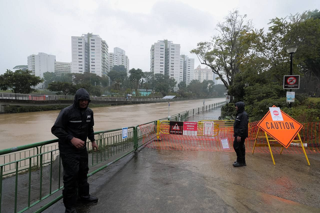
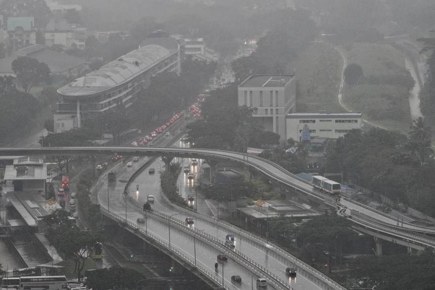
In the event of a storm, the park area doubles up as a conveyance channel, carrying the rainwater downstream gradually.
ST PHOTO: SHINTARO TAY

The park is functioning exactly as intended - with a canal that channels rainwater downstream.

A stream running through the park is part of the Kallang River, but is also a naturalised canal designed to accommodate "fluctuating water levels"

Ng Wei Kai
PUBLISHED 2 JAN 2021
SINGAPORE - Photos of high water levels in the Bishan-Ang Mo Kio Park have caused some netizens to assume it is flooded, but the park is functioning exactly as intended - with a canal that channels rainwater downstream.
The spike in the water levels comes from torrential rain over the past few days, but this is part of the normal functioning of the park's waterway. A stream running through the park is part of the Kallang River, but is also a naturalised canal designed to accommodate "fluctuating water levels" which may rise as high as 3m.
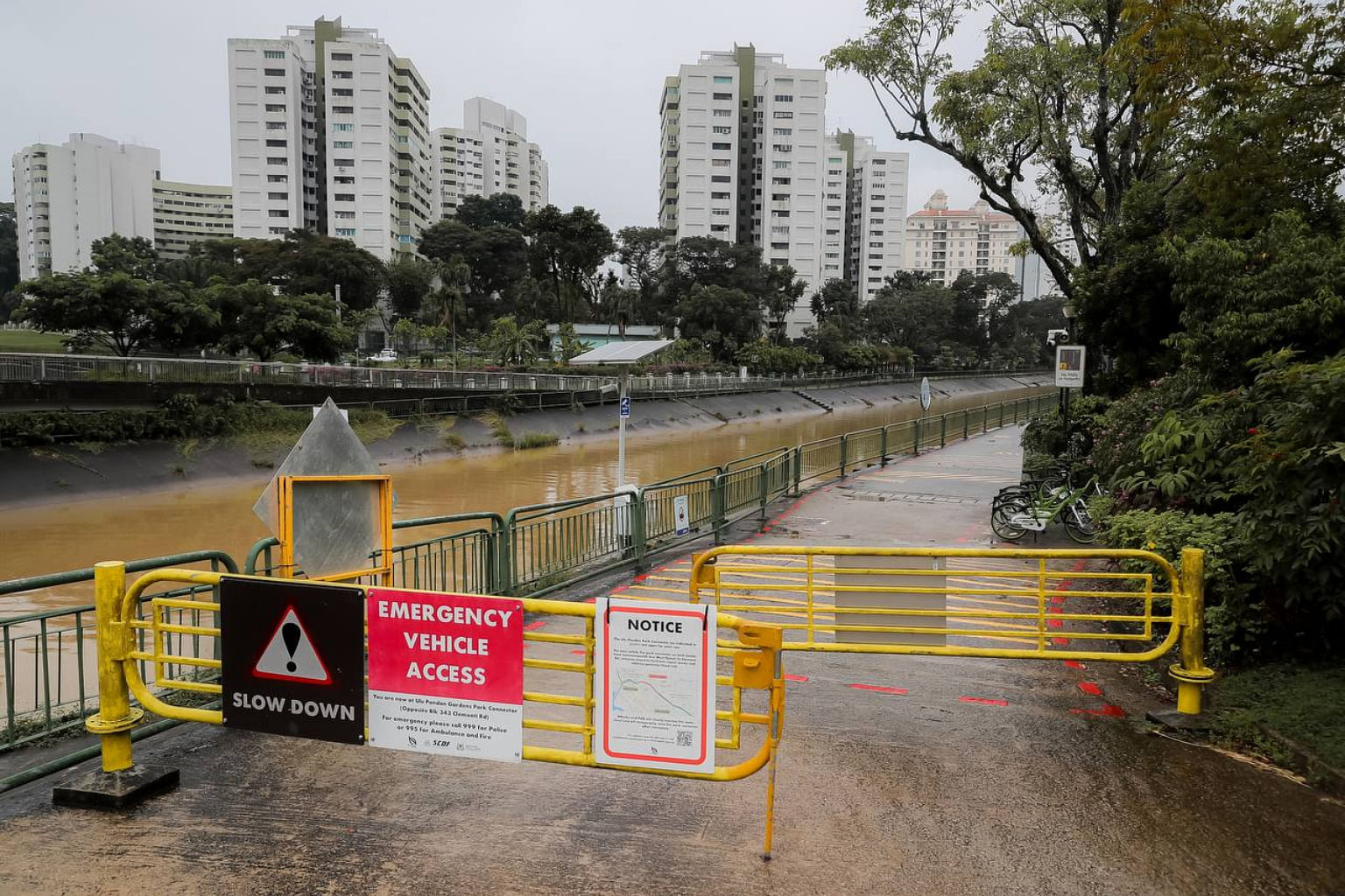
According to information on the National Parks Board (NParks) website, there are safety features visible in the park to ensure that members of the public are aware of impending high water levels.
"A river monitoring system with water level sensors is in place to provide early warning in the event of impending heavy rain or rising water levels. Warning signs, red makers, life buoys and CCTVs have also been put up along the river," says the website.
The redevelopment of the waterway from 2009 to 2012 was a joint collaboration between national water agency PUB and NParks under the Active, Beautiful, Clean (ABC) Waters Programme.
According to the PUB website, the river channel was designed based on a floodplain concept and is linked to a network of drains in the city. A floodplain is an area of land adjacent to a stream or a river which fills with water during periods of high discharge.
During dry weather, the flow of water is confined to a narrow stream in the middle of the river.
In the event of a storm, the adjacent park area doubles up as a conveyance channel, carrying the rainwater downstream gradually.
The naturalisation of the Kallang River serves both functional and aesthetic purposes.
"Under the ABC Waters Programme, a combination of plants, natural materials such as rocks, and civil engineering techniques were introduced to soften the edges of the waterway, give it a natural appearance and prevent soil erosion," says the PUB website.
In the event of a storm, the park area doubles up as a conveyance channel, carrying the rainwater downstream gradually.
ST PHOTO: SHINTARO TAY
The park is functioning exactly as intended - with a canal that channels rainwater downstream.
A stream running through the park is part of the Kallang River, but is also a naturalised canal designed to accommodate "fluctuating water levels"
Ng Wei Kai
PUBLISHED 2 JAN 2021
SINGAPORE - Photos of high water levels in the Bishan-Ang Mo Kio Park have caused some netizens to assume it is flooded, but the park is functioning exactly as intended - with a canal that channels rainwater downstream.
The spike in the water levels comes from torrential rain over the past few days, but this is part of the normal functioning of the park's waterway. A stream running through the park is part of the Kallang River, but is also a naturalised canal designed to accommodate "fluctuating water levels" which may rise as high as 3m.
According to information on the National Parks Board (NParks) website, there are safety features visible in the park to ensure that members of the public are aware of impending high water levels.
"A river monitoring system with water level sensors is in place to provide early warning in the event of impending heavy rain or rising water levels. Warning signs, red makers, life buoys and CCTVs have also been put up along the river," says the website.
The redevelopment of the waterway from 2009 to 2012 was a joint collaboration between national water agency PUB and NParks under the Active, Beautiful, Clean (ABC) Waters Programme.
According to the PUB website, the river channel was designed based on a floodplain concept and is linked to a network of drains in the city. A floodplain is an area of land adjacent to a stream or a river which fills with water during periods of high discharge.
During dry weather, the flow of water is confined to a narrow stream in the middle of the river.
In the event of a storm, the adjacent park area doubles up as a conveyance channel, carrying the rainwater downstream gradually.
The naturalisation of the Kallang River serves both functional and aesthetic purposes.
"Under the ABC Waters Programme, a combination of plants, natural materials such as rocks, and civil engineering techniques were introduced to soften the edges of the waterway, give it a natural appearance and prevent soil erosion," says the PUB website.