So it appear that god is set to see no more Bakayaros.
http://factsanddetails.com/japan/cat26/sub160/item2768.html
http://factsanddetails.com/japan/cat26/sub160/item2768.html
LARGE FUTURE EARTHQUAKES AND TSUNAMIS IN JAPAN: TOKAI AND NANKAI EARTHQUAKES AND,TOKAI-TONANKAI-NANKAI TRIPLE MEGAQUAKES
FUTURE EARTHQUAKES IN JAPAN
Tokai earthquakes, which have epicenters in Ise Bay, and Nankai earthquakes, which have epicenters in Suruga Bay and off Shikoku and the Kii Peninsula, are the most feared and destructive quakes. They occur every 100 to 150 years in areas where a lot of people now live and often take place almost simultaneously or sequentially, potentially producing several quakes of magnitude of 8.0 or above. If an earthquakes occur they could cause damage from Tokyo to Kyushu and destroy around 350,000 homes and kill between 12,000 and 21,000 people.
Scientists say there is a 99 percent chance that a major earthquake will occur in the next 30 years off the coast of Miyagi Prefecture, where the North American and Pacific plates meet and there is a lot of stress and movement. The scientist have also calculated there is an 88 percent chance of a “big one” occurring there in 20 years and 39 percent in 10 years.
Major Earthquake Zone Newly Found off Tohoku
In January 2012, the Yomiuri Shimbun reported: “At least three magnitude-9 level earthquakes may have occurred at intervals of 1,000 to 1,200 years in the Pacific Ocean along coastal prefectures from Aomori to Iwate, a Hokkaido University researcher concluded in study published in Kagaku (Science) magazine. Before, the area has not been considered a potential zone for major earthquakes. [Source: Yomiuri Shimbun, January 27, 2012]
The discovery was made by Kazuomi Hirakawa, a visiting professor at Hokkaido University. Hirakawa had examined samples of tsunami deposits collected at the Shimokita Peninsula in Aomori Prefecture and other areas after the Great East Japan Earthquake on March 11. He also analyzed data tracing tsunami over the past 3,500 years along the Pacific coast of Hokkaido and the Tohoku region.
Based on his findings, Hirakawa believes major earthquakes centered near the Shimokita Peninsula and the Rikuchu region further south occurred three times at intervals of 1,000 to 1,200 years. The first one is believed to have occurred 3,000 years ago, with another around the beginning of the first century, and the last occurring in the 12th or 13th century.
Currently, there are two known earthquake regions along the Pacific coastal area from Hokkaido to the Tohoku region. One is the area where the March 11 quake was centered. The other is in the area from Nemuro to Erimomisaki cape in Hokkaido, where major magnitude-8 level quakes have occurred every 500 years. Until Hirakawa's findings, there was no information about the region between the two areas.
Increased Likelihood of Another Strong Earthquake in Japan
The massive magnitude-9 March 11 temblor, the largest in the nation's history of scientific earthquake observation, is reminiscent of an earthquake an ancient document says struck in 869 during the Jogan era and caused a great deal of damage in the Tohoku region. [Source: Yomiuri Shimbun, January 18, 2012]
According to Akira Sangawa, a guest researcher specializing in seismological archaeology at the government-funded National Institute of Advanced Industrial Science and Technology, right around the 9th century, when the Jogan earthquake occurred, Japan was in a period of frequently occurring earthquakes. "Judging from [the trend in] recent years, this country may again be in a phase of active seismological events," Sangawa said.
This view is shared by many other experts who believe that Japan, after the 1995 Great Hanshin Earthquake, entered an active period of seismological activity, and that there is a significantly high possibility of another massive earthquake occurring before the end of the 21st century.
The edges of four tectonic plates meet beneath the Japanese archipelago, and the incidence of volcanic eruptions increases depending on the plates' activities. There were a series of eruptions at Mt. Shinmoedake in southern Kyushu at the beginning of 2011, while the number of major eruptions, called explosive eruptions, at Mt. Sakurajima in Kagoshima Prefecture, registered a record high, surpassing 900 compared to the previous high of 896 in 2010.
In this "archipelago of frequently occurring natural disasters," abnormalities such as unpredictable, sudden downpours called "guerrilla cataracts," huge typhoons and intense heat waves have become conspicuous in recent years. Experts have been alarmed by these phenomena, calling them "meteorological aberrations."
Tokai Earthquakes
In 2009, scientists at the Earthquake Research Committee said there was an 87 percent chance that a massive quake registering 8 or more on the Richter Scale would occur before 2040 in area south of Tokyo and east of Mt. Fuji that Japanese call Tokai. The epicenter of this Tokai quake is expected to be in the west-central area of Shizuoka Prefecture about 160 kilometers southwest of Tokyo.
Tokai earthquakes describe potentially catastrophic earthquakes that occur in the Tokai region. After a series of small earthquake occurred there in the 1970s scientists predicted that a major earthquake might be imminent. A law passed in 1978 mandated the measures must be taken to prepare for such a quake. According to one prediction a major Tokai quake could result in 7,900 to 9,200 deaths and cause $310 billion in damage. An earthquake preparedness center in Shizuoka has identified 6,449 likely landslide locations and deemed 58,540 houses vulnerable to quake-started fires. [Source: National Geographic]
A major earthquake hasn’t occurred in the Tokai area since in 1854 but the area is very seismically active and general feeling is an earthquake is due. The earthquake would be generated by activity along the Nankai Trough, which is located of the coast of Honshu and is where the Philippine plate slides under Japan. The land near Shizuoka is sinking towards this trough at a rate of five millimeters a year.
In the Tokai area the Philippine Plate is sliding under the Eurasia Plate. In a process called “crustal deformation,” a sharp-edged peninsula that juts into the sea is being pushed down several millimeters a year. A quake that releases the pressure could cause the land to jump up several meters, producing a catastrophic quake. The Tokai region is hit by such quakes every 150 years or so. The last one was in 1857.
The Tokai Earthquake, which is predicted to strike off Suruga Bay, is expected to be preceded by a "precursor slide" triggered when pressure that has built up along the boundaries of two plates causes one of them to slip under the other. Observation equipment has been set up to monitor any movement of the crusts. [Source: Yomiuri Shimbun, May 21, 2011]
87 percent Chance of Tokai Earthquake
The 87 percent figure was released by the government's Headquarters for Earthquake Research Promotion, but the headquarters regards it as a so-called reference figure. It is not a probability in a scientific sense. This is because no massive Tokai earthquake has occurred in isolation in the course of recorded history.
Why then have scientists assumed that a large Tokai quake can occur at any time? Along the Nankai Trough stretching from off the Tokai region to off Shikoku, strong ocean-trench earthquakes have repeatedly occurred every 100 to 150 years. There has not been a massive earthquake in the Tokai region since 1854. Thus scientists assume that distortion in the Earth's crust has continued to accumulate.
The forecast of a huge Tokai quake was first put forward by Katsuhiko Ishibashi, professor emeritus of Kobe University, who announced his theory to an academic society in 1976. The government devised special legislation to improve systems for forecasting the quake. The 87 percent probability figure was based on the frequency of past Tokai quakes that occurred in tandem with Tonankai and Nankai earthquakes.
However, there has not been a Tokai quake in the more than 30 years since the forecast. Observation data from the period shows that distortion in the Earth's crust in the focal area of the forecast Tokai quake has accumulated less than half as quickly as in the focal area of the forecasted Tonankai quake. Also, research on documents preserved at temples and shrines, and on material deposited by tsunami in a wide range of areas, has not confirmed the occurrence of an isolated Tokai quake.
In January 2011, the government's Headquarters for Earthquake Research Promotion deemed that the probability of a Tonankai quake occurring within 30 years was 70 percent, and the probability of a Nankai quake was 60 percent.
The headquarters has warned that the risk of a massive earthquake along the Nankai Trough has been increasing yearly. According to Prof. Koshun Yamaoka of Nagoya University, "The possibility of an isolated Tokai quake can't be ruled out. But since one hasn't occurred in the past, the headquarters' probability figure is not meaningful." However, Yamaoka added: "When the next Tonankai quake occurs, it's highly likely a Tokai quake will happen in conjunction with it. Taking that into account, I estimate the probability of a Tokai quake within 30 years to be at least 70 percent."
Nankai Trough Earthquakes
The Nankai Trough is a shallow ocean trench created in an area where the huge Philippine Sea Plate subducts beneath a landward plate. A giant earthquake is predicted to occur at or near a boundary of the plates. A trough is an underwater depression, or trench, lies at the intersection of a plate on the land side and a plate on the sea side.. The Nankai Trough originates from Suruga Bay, west of the Izu Peninsula. It extends to the seabed off the southern part of the Japanese archipelago, which is about four kilometers deep off the Shikoku and Kyushu regions. Along the Nankai Trough, the Philippine Sea Plate is moving beneath a land-side plate at a rate of several centimeters per year, dragging with it part of the latter at the point where they meet. When the land-side plate has been pulled to a certain extent, it is bound to spring back with tremendous force. This is how a massive earthquake occurs where plates meet. [Source: Yomiuri Shimbun, April 17, 2012]
In August 2013, the Cabinet Office forecast that the death toll from a huge Nankai quake could top 300,000, compared with roughly 19,000 from the March 2011 earthquake and tsunami. The Cabinet Office panel also expects evacuees to number as high as 9.5 million a week after a Nankai Trough quake because of inadequate lifelines, noting that 40 prefectures could sustain damage to buildings and other infrastructure.
A massive earthquake believed to be a Nankai earthquake occurred in 794 when the capital was transferred from Heijokyo in Nara Prefecture to Heiankyo in Kyoto Prefecture, according to historical documents, Katsunori Imazu, an associate professor at Okayama University told the Yomiuri Shimbun. Nankai earthquakes are believed to occur in 100-year cycles, but historical documents from a 200-year period before and after the earthquake have not been found. Imazu said the 794 earthquake occurred in the middle of this blank period. [Source: Yomiuri Shimbun, April 20, 2012]
“Imazu found a statement that suggests the occurrence of a massive earthquake in a historical document called Nihon Kiryaku, which was compiled in the Heian period (794-1192) and summarizes the contents of Nihon Koki, an officially commissioned Japanese history text. The statement dated July 10, 784, says: "The earthquake hit the imperial court as well as the government quarters and houses in Keiki [modern-day Kyoto and its surrounding areas]. People died due to the earthquake." He also found statements related to the earthquake that said the Nankaido, an ancient road along the coast of Shikoku, was shut down and a new road was built two years later. Imazu concluded the 794 earthquake was a Nankai earthquake because the epicentral area was estimated in the Pacific, and said the Nankaido was closed due to a tsunami following the quake. [Ibid]
Massive Tsunami Generated by a Nankai Trough Earthquake Could Affect 11 Prefectures
In April 2012, the Yomiuri Shimbun reported: A tsunami of 10 meters or higher could strike 11 prefectures, including Tokyo, and an earthquake with an intensity of 7---the highest level on the Japanese seismic scale---could devastate an area 20 times larger than previously predicted if the Nankai Trough triggers a triple quake simultaneously, according to a revised forecast by the Cabinet Office. [Source: Yomiuri Shimbun, April 2, 2012]
The Nankai Trough quake is forecast to occur off the southern Japan coast if the so-called Tokai, Tonankai and Nankai earthquakes occur simultaneously. This could result in tsunami as high as 34.4 meters in Kuroshio, Kochi Prefecture, and tsunami of at least 10 meters in 90 municipalities in the 11 prefectures.
Using scientific data, a Cabinet Office study panel on Saturday released its predictions on maximum seismic intensity levels and the heights of tsunami at high tide if the simultaneous earthquakes occur. The maximum height of tsunami expected to hit the Pacific coast in southern Japan could be twice to three times higher than previously forecast, the team said. In the region around Chubu Electric Power Co.'s Hamaoka nuclear power plant in Omaezaki, Shizuoka Prefecture, an earthquake with an intensity of 7 and a 21-meter-high tsunami---higher than the company's previous forecast--- were predicted.
About 69,000 square kilometers in 687 municipalities in 24 prefectures would be affected if the maximum intensity of a quake was lower 6 or stronger, according to the forecast. This area is more than three times larger than previously predicted. The area would include about 7,000 square kilometers in 153 municipalities in 10 prefectures, including Shizuoka, Aichi and Kochi, which would be hit by a quake with an intensity of 7.
The panel also calculated tsunami scales based on 11 different patterns of tectonic plate movement. The predicted heights of tsunami exceed 20 meters in 23 municipalities in Tokyo and five other prefectures. In two locations in Kochi Prefecture, the heights were predicted to top 30 meters. In the previous forecast, the maximum height was predicted to be 17 meters in Shimanto, Kochi Prefecture. In the Great East Japan Earthquake, a point 33 meters above sea level was flooded by the tsunami that hit Minami-Sanriku, Miyagi Prefecture.
The panel released the maximum possible temblor levels and tsunami heights to encourage people to make preparations. The projections do not necessarily mean that all the locations mentioned in the study would be simultaneously struck by a massive earthquake and tsunami. However, Shizuoka and three other prefectures are close to the areas where tsunami could occur. The panel predicted that one-meter-high tsunami could reach the coast two to three minutes after an earthquake. Evacuation of residents in the prefectures could present a problem.
The Central Disaster Management Council will release envisaged death tolls and destruction of buildings around June, and economic damage in autumn. The council will then compile the outline for antidisaster measures as early as next spring.
Nankai Quake Could Cost $2.2 Trillion
A Nankai Trough earthquake and ensuing tsunami could shave almost 10 percent off Japan's gross domestic product. The Yomiuri Shimbun reported: “A 9.0-magnitude temblor with an epicenter in the Nankai Trough off central and western Japan would cause about ¥220 trillion ($2.2 trillion) in damage, more than twice the entire fiscal 2013 budget, a Cabinet Office panel said. While the figure is far larger than the ¥17 trillion in damage wrought by the March 2011 Great East Japan Earthquake and the ¥10 trillion caused by the 1995 Great Hanshin Earthquake, the estimate does not include the cost of fallout if nuclear power plants are damaged in a Nankai temblor. As it is, the ¥17 trillion figure for the March 11, 2011, calamity doesn’t cover the costs of the three reactor meltdowns at the Fukushima No. 1 plant. [Source: Kyodo, March 19, 2013]
Of the total forecast damage costs, property and infrastructure would account for ¥169.5 trillion and reduced production and services ¥44.7 trillion. Property damage would be halved to ¥80 trillion if all houses and key structures are made quake-resistant, the Cabinet Office said.
The report also said 27.1 million households would suffer from power outages, 34.4 million people would lose water, and the Tomei Expressway linking Tokyo with Nagoya and the Shin Tomei Expressway, which runs through areas more inland, would be closed. It also estimates that due to public transport disruptions, some 1.1 million people in Aichi, Mie and Gifu prefectures would be unable to get home after the temblor. Historically, earthquakes with a magnitude of about 8.0 occur along the Nankai Trough once every 100 to 150 years, with the last one hitting in 1946. The Cabinet Office reported Monday that a Nankai earthquake could cause 44.7 trillion yen in economic damage, or 9.3 percent of GDP, over a broad swath of the Pacific coast. Many companies could see factories idled,.
Damage from the Nankai Quake
The Yomiuri Shimbun reported: “A Nankai Trough earthquake would severely disrupt public transportation networks, particularly major arteries connecting the nation's two biggest urban areas, resulting in havoc if they remained closed for long, a government estimate has shown. The Tokaido Shinkansen line, which is used by about 391,000 passengers per day, would be forced to stop operations immediately after a huge quake in the Nankai Trough. [Source: Yomiuri Shimbun, March 20, 2013 <<>>]
Shinkansen operations could resume within a day of the potential disaster for areas with tremors registering upper 5 or lower on the Japanese intensity scale of 7. For areas with stronger tremors, it would take about one month to resume operations because utility poles, power lines and other facilities would likely sustain serious damage. <<>>
This scenario, however, would be only possible if the earthquake did not cause a rail accident. If the damage from a train derailed by a Nankai Trough earthquake were similar to the damage that the Niigata Prefecture Chuetsu Earthquake inflicted on the Joetsu Shinkansen line in 2004, JR Tokai would have to spend about two months removing the derailed train from the track and conducting repair work before operations could resume. <<>>
JR Tokai will spend about 270 billion yen by fiscal 2020 on measures to prevent derailment and other anti-disaster measures. West Japan Railway Co., the operator of the Sanyo Shinkansen line, will set up guide rails to keep the wheels of the train from slipping off the main rails for the section between Shin-Osaka Station in Osaka Prefecture and Himeji Station in Hyogo Prefecture.
Potential Ground Zeros for Nankai Tsunami
According to a prediction released by a Cabinet Office study panel in March 2012, a tsunami up to 34 meters high could slam into the town of Kuroshio, Kochi Prefecture in the event of a Nankai Trough earthquake. A direct hit by a tsunami of that scale would submerge most of the coastal areas that 80 percent of the town's population of 13,000 occupy. "I used to just think of it as beautiful, but it looks totally different to me now. I'm always thinking about evacuation," Satoju Myojin, a 57-year-old homemaker who lived in Kuroshiro much if her life, told the Yomiuri Shimbun. [Source: Tetsuya Kikumasa and Osamu Kanazawa, Yomiuri Shimbun, November 2012]
The Yomiuri Shimbun reported: “Spurred by the dire prediction, the town decided to build new evacuation routes to higher ground that are equipped with solar-powered lights. The town is constructing 70 escape routes in this fiscal year, but local residents say at least another 200 are needed. Preparations have not stopped there. With senior citizens accounting for a third of the town's population, mutual aid would be an important part of any evacuation effort. [Ibid]
The worst-case scenario predicts 109,000 tsunami deaths in Shizuoka Prefecture. Privately run Hanazono Kindergarten in Hamamatsu built an evacuation platform 16 meters above sea level on top of its three-story building in March. Since the kindergarten is only two kilometers from the coastline, it has also readied life jackets for all of its about 360 children. A nursery school near the coast plans to purchase two lifeboats, equipped with food and satellite phones, for about 100 children. [Ibid]
Science Behind the Finding About the Massive Nankai Trough Tsunami
The Yomiuri Shimbun reported: The study panel this time reconsidered this scenario based on lessons learned from the Great East Japan Earthquake, and assumed tectonic plates moved simultaneously over a wider area than those previously predicted. Late last year, the panel doubled the size of the predictable focal area and raised the maximum magnitude from 8.7 to 9.0, projecting that areas closest to the trough would be hit by especially high tsunami.
On the basis on these assumptions, the panel greatly enhanced the envisaged maximum intensity levels and tsunami scales. Because the distribution of intensity levels changes depending on the occurrence of quakes, the panel calculated figures based on five different patterns. Earthquakes along Nankai Trough usually occur in separate areas, such as in the Tonankai and Nankai regions.
The possibility of such a gigantic earthquake with a wide focal area as the one predicted in the latest study is extremely remote. Scientists predict such a quake occurs at intervals of about 800 years. But the panel made the projection as the worst-case scenario, which would cause massive damage. In conventional methods, the huge scale of quakes and tsunami were assumed based on records in ancient documents and other data from the past. However, these methods are unable to predict rare worst-case scenarios.
Based on lessons learned from the Great East Japan Earthquake, the government changed its policy to scientifically predict the largest possible earthquake and tsunami. In the Great East Japan Earthquake, the boundary of a tectonic plate on the side of a sea trench moved up to 50 meters, triggering the massive tsunami. Therefore, the latest study identified areas where particularly large tsunami could occur. Locations inside the focal area where strong quakes could occur were moved closer to land than previously forecast. As a result, both the tsunami height and the intensity scales turned out to be far greater than previous projections.
Tokai, Tonankai and Nankai Triple Megaquakes
Tokai, Tonankai and Nankai earthquakes, which experts say could occur in conjunction, could produce massive damage and a tsunami that could pose a serious risk to nuclear power plants. This was one reason why Prime Minister Naoto Kan requested that Hamaoka nuclear power plant in Omaezaki, Shizuoka Prefecture be the shutdown. Kan cited an 87 percent "probability" that a magnitude-8 Tokai quake will occur within 30 years.
In 2003, the government's Central Disaster Management Council predicted simultaneous Tokai, Tonankai and Nankai earthquakes could occur. The Nankai Trough is an abyss stretching from Suruga Bay to off Shikoku and Kyushu. It is also where the Philippine Sea Plate sinks below another plate. According to a Yomiuri Shimbun article in areas between the Tokai and Tonankai troughs, and along Nankai Trough, magnitude-8 earthquakes occur every 100 to 150 years. Scientists assume simultaneous quakes occur every 300 to 500 years. Scientists also envisage an even more gigantic earthquake if other quakes occur at the same time as the simultaneous quakes, although this possibility is regarded as slim.
The government's Central Disaster Management Council has estimated that if only a Tokai earthquake were to occur today, the damage would reach 37 trillion yen and 10,000 people would be killed under collapsed buildings and in the ensuing tsunami. But should a megaquake hit on the order of the 1707 Hoei quake- (See Below) -involving simultaneous ruptures in the Tokai, Tonankai and Nankai zones--large tsunami are expected to hit an area from the Izu Peninsula all the way down to Kyushu. The council estimates damage would range from 53 trillion yen to 81 trillion yen, the death toll would reach 25,000 and 550,000 homes and buildings would be destroyed. Since the destruction left by such a quake has been predicted to be on par with that caused by the Great East Japan Earthquake, many seismologists are working to advance research on the issue.
History of Tokai, Tonankai and Nankai Triple Megaquakes and Tsunamis
The magnitude-8.6 Hoei earthquake of 1707 was the most powerful earthquake involving simultaneous ruptures this country has ever seen. The enormous quake involved Tokai, Tonankai and Nankai temblors occurring simultaneously. This megaquake and the ensuing tsunami killed more than 20,000 people and destroyed at least 80,000 houses.
"Earthquakes in 887 and 1361 must have involved simultaneous ruptures in all three zones [Tokai, Tonankai and Nankai],"said Yoshinobu Tsuji, associate professor at the Earthquake Research Institute of the University of Tokyo.
Tsuji has studied ancient documents at Horyuji temple in Nara Prefecture that describe a tsunami that hit Osaka after the Shohei Nankai earthquake in 1361. The writings say the tsunami reached about one kilometer farther inland than the wave following the Hoei quake. A text from the Heian period (794-1192)--"Nihon Sandai Jitsuroku" (The True History of Three Reigns of Japan)--describes enormous tsunami damage to Osaka after the Ninna Goki Shichido earthquake in 887.
"It's already been more than 300 years since the Hoei earthquake. Judging from the frequency that's been recorded, there's about a 30 percent chance of a major earthquake occurring soon in this region--one where a rupture in one zone happens at the same time as quakes in the other two," Tsuji said, also saying detailed preparations needed to be made.
Meanwhile, the Keicho earthquake that occurred in 1605 did not involve strong earth movements, but the subsequent tsunami caused extensive damage from the Kanto region to Shikoku. This earthquake occurred at a shallow point under the seabed near the Nankai Trough, which triggered a major tsunami via a mechanism different to those caused by the simultaneous ruptures described above.
Detecting a Tokai earthquake is thought possible because a pre-slip slide may occur first. Some scientists think the Shizuoka earthquake in August 2009 increased the likelihood of the feared Tokai quake and have made it likely to occur sooner. Other scientists are not so sure.
Area of Focal Regions for Megaquake Doubled
In December 2011, the Japanese government reported that the possible focal regions for a megaquake that experts say could occur along the Nankai Trough off the southern coast should be doubled in size from previous estimates. The interim report was compiled by a panel of experts tasked with reviewing possible scales of the Tokai, Tonankai and Nankai earthquakes that could occur around the Nankai Trough. The underwater trough stretches from Suruga Bay off Shizuoka Prefecture to areas off Shikoku and Kyushu. With the expansion of possible focal regions, the magnitude of the megaquake could be 9 or higher should the three earthquakes occur concurrently, according to the report.
Under previous estimates, possible focal regions for the megaquake covered an area of about 61,000 square kilometers, at a depth of about 10 to 30 kilometers, stretching from Suruga Bay to areas off Shikoku. The revision was based on the results of recent studies, with the newly estimated possible focal regions covering an area of about 110,000 square kilometers, expanding to the north and southwest.The newly added region on the north side has been struck by earthquakes that generated low-frequency seismic waves at a depth of about 30 kilometers or deeper. The report also included areas off Miyazaki Prefecture as part of the newly estimated possible focal regions because of the likelihood that a magnitude-7.5 quake could occur in the area in conjunction with the three quakes.
The newly estimated possible focal regions have also been expanded to the east to cover the plate boundaries in Suruga Bay, as well as a belt of fault lines centered on the mouth of the Fujikawa river, which flows into the bay. The interim report stated that tsunami would be triggered by not only the newly estimated possible focal regions, but also an area south of the regions at a depth of about 10 kilometers or less.
Recent studies involving drilling into the seabed have found that branching faults there have previously caused tsunami. The Great East Japan Earthquake also caused low-depth areas to move in conjunction, resulting in a major tsunami.
Nankia Triple-Quake Could Kill 400,000 (360,000 from the Tsunami)
In July 2012, the Yomiuri Shimbun reported: “As many as 400,000 people could die, mainly in Pacific coastal areas from Shizuoka to Kochi prefectures, if a Nankai Trough triple earthquake occurs, according to a new prediction by Kansai University Prof. Yoshiaki Kawata. In 2003, the government's Central Disaster Management Council predicted the death toll from a magnitude-8.7 triple quake would be about 25,000 at most. [Source: Yomiuri Shimbun, July 11, 2012]
“After the March 2011 earthquake and tsunami the Japanese government raised the magnitude to 9 and unveiled in March its prediction of a Nankai Trough quake's maximum seismic intensity and the height of ensuing tsunami. Kawata made the prediction based on an assumed temblor striking in the middle of the night when most people are at home and would have difficulty evacuating to safe places. The death toll was calculated based on an assumed quake of at least lower-6 intensity occurring in an area with a population of 47 million; the death toll from the tsunami after the March 11, 2011, quake; and data from other past large-scale temblors. [Ibid]
“Kawata predicted about 360,000 people would die as a result of quake-triggered tsunami in Pacific coastal areas in Shizuoka, Aichi, Mie, Wakayama, Tokushima and Kochi prefectures. He also estimated there would be about 47,000 quake-related deaths in wider areas, including Osaka and Hyogo prefectures. He predicted a death toll of about 120,000 if the quake occurs during the day, as 70 percent of people would be able to flee to safer places. "The prediction is much more severe than the death toll from the Great East Japan Earthquake. But the 400,000 figure is not groundless conjecture," Kawata said. "I want people to fully understand how dangerous [such a disaster] would be and to think about disaster prevention measures.” [Ibid]
Up to 323,000 people could die if three earthquakes occur simultaneously along the Nankai Trough, killing about 70 percent of victims in subsequent tsunami, according to new predictions by two Cabinet Office panels. The Yomiuri Shimbun reported: “For the worst-case scenario in which 323,000 people could die, the working group made its prediction based on an assumption that the quake would occur at midnight during winter, when many people are expected to be home, and cause serious damage in the Tokai region. According to the working group's predictions, 623,000 people could be injured and 311,000 people could require rescue. [Source: Yomiuri Shimbun, August 31, 2012]
In another scenario, about 32,000 people could die if the Nankai quake occurs at noon in the summertime, when many people are expected to be away from home, and causes serious damage in the Shikoku and Kyushu regions. This represents the case with the lowest death toll among the predictions.Alternatively, if the triple quake occurs at 6 p.m. in wintertime, when many people use fires for things like cooking and heating, up to about 2.39 million buildings could collapse or burn down. [Ibid]
The working group also estimated the effects of disaster prevention measures. For example, if 70 percent of people concerned started evacuating within 10 minutes after a midnight quake and took refuge in tsunami evacuation buildings, the tsunami death toll would drop by up to 80 percent. The study panel predicted that up to 1,050 square kilometers of land would be inundated, 1.8 times more than the area flooded in the Great East Japan Earthquake and tsunami. [Ibid]
Future Tokyo Earthquake
There is a good change that a catastrophic earthquake will occur in Tokyo area in the not too distant future. According to one government agency an earthquakes as strong as the 7.9 magnitude one in 1923 would kill 152,000 people and injure another 205,000. An earthquake with 7.2 magnitude like the one in Kobe would kill 7,160 and injure 158,032.
If a powerful earthquake like the one scientists predict strikes Tokyo an estimated 13,000 people will died and 800,000 homes will be destroyed. The damage estimate foe a 7.2 earthquake is over $1 trillion.
In his book Sixty Seconds That Will Change the World-The Coming Tokyo Earthquake, Japan-based British geologist and journalist Peter Hadfield predicts that when the pressure on the Eurasian plate is too great, it will whip up, causing a magnitude 8 quake that will thrust the Tokai region into a wild fit of shaking, which extend as far as Tokyo.
The greater Tokyo area today, in addition to being financial, political and administrative center of Japan, is home to 33 million people. Hadfield wrote: "Envisage Los Angeles, New York, Chicago, Washington, Houston, New Orleans, Philadelphia and Detroit, plus the next 42 largest cities of the United States---whose combined populations equal one quarter of the United States---with all their attendant financial, political, mercantile and petroleum-refining resources, grouped into one continuous urban conglomeration...Put that on top of the San Andreas fault and watch the sparks fly."
Some estimate that the cost of a massive earthquake in Tokyo could reach $2 trillion dollars, sinking Japan into great debt and possibly setting off an economic crisis and this could damage the world economy by setting off a series of negative events that spiral out of control.
The damage could be particularly nasty if the earthquake occurs on a windy day and winds cause the fires to spread as they did in 1923. Neighborhoods with wooden houses and narrow roads---that might get blocked, preventing fire trucks from entering---would be particularly devastated. If the earthquake strikes in the morning it is estimated thousands will be crushed in buildings. If it occurs in the afternoon thousands would perish in fires. One of the biggest concerns is the liquidization of the ground under major high-rises.
Among the problems that are likely to occur are the stranding of hundreds of thousands of people at train stations and in their offices with no way to get home if the quake occurs during working hours and the trapping of tens of thousands in elevators. Gas and water lines would break. Some bridges and elevated highway may be severely damaged; roads are likely to be clogged with vehicles as people trying to get home or flee. Roads and railways in eastern Tokyo are expected to sustain the most damage because the ground is loose there. The ground under the runways at Haneda airport may liquify. Many roads along the Arakawa river expected to be blocked. There is the potential for mass panic.
Probability of Major Quake in the Tokyo Area Rated High
In December 2012, the Japanese government upgraded the probability of a powerful earthquake- striking the Tokyo region within 30 years, with Mito at 62 percent and Chiba at 75 percent. The Yomiuri Shimbun reported: “The Earthquake Research Committee of the government's Headquarters for Earthquake Research Promotion released an earthquake probability map. Taking into consideration the effect of the Great East Japan Earthquake, the committee upgraded the magnitude of earthquakes predicted in waters off the quake-hit regions, compared with the 2010 map. [Source: Yomiuri Shimbun, December 23, 2012]
The committee predicted a quake with a maximum magnitude of 8 could occur off Ibaraki Prefecture or the Boso Peninsula--where plate boundary deformations associated with earthquakes remain. The probability of being hit by large quakes grew dramatically, mainly in the coastal areas of the Kanto region, at 62.3 percent in Mito and 75.7 percent in Chiba. [Ibid]
The probability is also high along the Nankai Trough--which stretches from off Shizuoka Prefecture to the Shikoku and Kyushu regions--where magnitude-8 quakes, such as the Tonankai and Nankai earthquakes, have repeatedly occurred. The map indicated Shizuoka had an 89.7 percent possibility and Tsu, 87.4 percent. The map shows the probability of the country's future earthquakes with an intensity of lower 6 or stronger in the next 30 years beginning Jan. 1 next year. [Ibid]
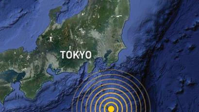
Big Tokyo Quake Forecast by 2016
In January 2012, the Wall Street Journal reported; “Researchers at Tokyo University’s Earthquake Research Institute said there’s a 70 percent probability the long-feared “big one” will hit the southern Kanto region, which includes Tokyo’s neon-lit jungle, by 2016. It’s an ominous consequence of last year’s game-changing magnitude 9.0 earthquake, the most powerful recorded to hit Japan. [Source: Yoree Koh,Wall Street Journal, January 23, 2012]
The government agency studying seismic activity has long said the odds of a mag-7-plus quake hitting Tokyo were 70 percent over 30 years. But Tokyo University researchers now say that the tireless bursts of quakes in the months since March 11 are a mathematical omen signaling a strong quake will occur far sooner than later. University researchers now say the odds of Tokyo or outlying suburban areas getting hit with such a powerful quake in 30 years are now 98 percent. According to the researchers, a large earthquake strikes in proportion to the number of smaller shakes ---measuring about magnitude-3 to 5---that break out in the region. In other words, the more small tremors there are, the greater the probability a devastating one will hit.
Based on observations from the Japan Meteorological Agency, the Tokyo University researchers said there has been a more-than-five-fold jump in the number of earthquakes measuring magnitude 6 or below in the Tokyo area since March 11. In all, there have been 577 earthquakes registering a magnitude-5 or above in Japan from March 11 to the end of 2011, about four times the average annual amount logged between 1996-2005, according to the JMA.
“The balance has changed since March 11,” Shinichi Sakai, a research associate at the Earthquake Research Institute, told JRT. Mr. Sakai said the March 11 quake jerked the fault lines underground in a way that has changed the coastal landscape as well as the sea bed below. It also mounted pressure on nearby sea floors like those beneath Hokkaido and the Kanto region. If the rate of smaller earthquakes persist, it is likely Tokyo will see a big one strike at its doorstep in the near future. “It’s the same as when one person in a line of people holding hands falls then those around him are likely to get pulled down too,” said Mr. Sakai. “The Kanto region is similarly being affected by the March 11 earthquake.”
Mr. Sakai said while pinpointing the exact location of where the pending temblor will take place is impossible, researchers will attempt to narrow down field of possibilities. He said they will also revise various scenarios of what would occur given the new time frame. The latest forecast has grabbed the attention local residents, with the term “within four years” trending on Twitter since early Monday. Some users on the microblogging site tweeted that while the threat of the big one hovered in the back of their minds, the new calculation has made them more aware of the need to make emergency preparations. By the afternoon, Japan’s major dailies had published the news prominently on their websites.
The last big quake to hit Tokyo was the Great Kanto earthquake, a magnitude-7.9 jolt that struck on Sept. 1, 1923. About 105,0000 were killed in the Tokyo metropolitan area, many of which were caused by crumbling houses and fires that quickly engulfed the city. Officials say stricter building codes and new technologies developed over the years would curb significantly the toll.
Future Tokyo Quake Could Register Seven, the Highest on the Japanese Scale
In February 2012, the Yomiuri Shimbun reported: A major earthquake a government panel presumes could occur centered under northern Tokyo Bay could register 7---the strongest on the Japanese seismic intensity scale---in central Tokyo, a ministry study has found. The new prediction came as a result of underground structure research by the Education, Culture, Sports, Science and Technology Ministry that showed an area of a plate boundary beneath Tokyo Bay is about 10 kilometers shallower than previously thought. With the new findings, the ministry said it plans to begin a review next fiscal year on current earthquake damage estimates as well as measures against the quake. [Source: Yomiuri Shimbun, February 22, 2012]
This is one of 18 major quakes the government's Central Disaster Prevention Council has calculated may occur with an epicenter beneath the Tokyo metropolitan area. The council has assumed the epicenter of the quake below northern Tokyo Bay would be at the boundary of a land plate and the Philippine Sea Plate, which subducts below the land plate. The quake's projected magnitude is 7.3.
The panel predicted in 2004 a quake would register a seismic intensity in the upper 6 range. The ministry's research team, made up of experts from universities and research institutions, placed seismographs at about 300 locations in the Tokyo metropolitan area between fiscal 2007 and 2011. The new data contradicted the panel's previous calculations that estimated the boundary was 30 kilometers to 40 kilometers below the seabed.
Based on the new research results, the team reestimated the possible seismic intensity of a quake after revising such data as the point where the plates would collide along the plate boundary. According to a new map that shows the estimated seismic intensity in the Tokyo area, the quake is now predicted to register an intensity of 7 in some areas, including central Tokyo, the eastern and southern parts of Tokyo's 23 wards, Kawasaki and Yokohama. The area registering an intensity of upper 6 would also be larger than the council previously assumed. Because such calculations change according to ground characteristics and other conditions, the research team intends to validate the findings and create a final quake intensity distribution map, the ministry said.
According to the panel's current damage estimates, if the predicted quake occurred below northern Tokyo Bay, 11,000 people would be killed and about 850,000 buildings would collapse or be burned down in the worst-case scenario. As quake predictions involve many uncertainties, this calculation of a plate-boundary quake is simply a possibility. However, in the wake of the March 11 Great East Japan Earthquake, which has given the nation a lesson in preparing for the worst, the government has been urged to thoroughly check whether its disaster preparedness for the capital is sufficient. An apparent urgent task for the government is making social infrastructure, such as utilities, and buildings resistant to earthquakes. If structures meet the current quake-resistance requirements, they are unlikely to collapse even in the event of a quake with an intensity of 7. But if the requirements are not met, even reinforced concrete structures could collapse.
A destructive tsunami has not been predicted to strike the Tokyo metropolitan area, but water gates and dikes might be broken after the presumed quake. In light of this, the government also apparently needs to take steps to prevent subway systems and low-lying coastal areas from being flooded.
Tokyo Bay Quake Map Predicts Strong Shaking
In March 2012, the Yomiuri Shimbun reported: Parts of the Tokyo metropolitan area could be shaken to the maximum level of 7 on the Japanese seismic intensity scale in the event of a major quake with its focus under northern Tokyo Bay, according to a new map by a science ministry research team. The map, by the team of the Education, Culture, Sports, Science and Technology Ministry, shows that strong seismic waves would spread underground in coastal areas of Tokyo and Kanagawa Prefecture in the event of a quake with a magnitude of 7.3. [Source: Yomiuri Shimbun, March 9, 2012]
Seismic waves would move at a maximum speed of 40 to 80 centimeters per second in the firm underground regions just above the quake's focal area or where plate boundaries stick strongly to each other, according to the latest estimates. Compared to the 2004 estimates, the research team has also expanded areas where seismic waves are predicted to run underground at a maximum of 20 to 40 centimeters per second.
Generally, if underground seismic waves move faster than 35 to 50 centimeters per second, the surface areas over them experience tremors of an intensity around upper 6--the point at which wooden houses begin collapsing. If the waves move at 50 to 75 centimeters per second, the corresponding surface areas would register the maximum intensity level of 7, according to the research team.
The latest projection by the team, made up of experts from the University of Tokyo's Earthquake Research Institute and other organizations, come as a result of underground structure research. In compiling latest estimates, the team changed the depth of a plate boundary beneath Tokyo Bay by making it five to 10 kilometers shallower than in previous calculations. The team also assumed that there are two locations where plate boundaries stick strongly to each other.
Tokyo Quake 'Could Be Stronger than Thought'
In April 2012, the Yomiuri Shimbun reported: Coastal areas in eastern Tokyo and northeastern Kanagawa Prefecture could be shaken to the maximum level of 7 on the Japanese seismic intensity scale if a magnitude-7.3 earthquake strikes under northern Tokyo Bay, according to a science ministry research team. The number of areas that could register upper 6 was nearly double that of previous estimates, the team added. [Source: Yomiuri Shimbun, April 1, 2012]
The Education, Culture, Sports, Science and Technology Ministry team on Friday released detailed maps showing the expected intensity of shaking such an earthquake would generate in the Tokyo metropolitan area and neighboring prefectures. The maps showed more intense shaking---and in more areas---than had previously been estimated by the government's Central Disaster Management Council. The central and local governments will likely need to review their disaster prevention measures.
The research team projected 18 possible scenarios involving strong earthquakes centered around Tokyo. Of them, an earthquake with its focus under northern Tokyo Bay is expected to cause the most serious damage to the capital and neighboring areas. Based on a recent study of the metropolitan area's subsurface structure, the team estimated the seismic intensity of each quake. The researchers assumed the predicted epicenter would be near the boundaries of plates about 20 kilometers to 30 kilometers underground--about 10 kilometers shallower than the previous estimates.They calculated that if the earthquake's focus is under northern Tokyo Bay, it could cause a level 7 quake in eastern Tokyo and northeastern Kanagawa Prefecture. An upper 6 quake is projected in northeastern Kanagawa Prefecture, eastern Tokyo, western Chiba Prefecture and southeastern Saitama Prefecture. The area likely to be damaged by the temblor was almost double previous projections.
In the team's projections for quakes with a focus under western Chiba Prefecture or coastal Tokyo, a level 7 quake is expected in some areas, including coastal areas of Tokyo. If a magnitude-7.1 earthquake with a focus 30 kilometers to 40 kilometers underground strikes northwestern Chiba Prefecture, the researchers estimated the shaking intensity could be level 7 in southern Ibaraki Prefecture and upper 6 in other parts of Ibaraki Prefecture and northern Chiba Prefecture.
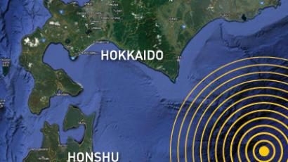
Thirty-Five -Meter-High Tsunami May Hit Hokkaido
Hokkaido's Pacific coast, the Yomiuri Shimbun reported, may be hit by tsunami as high as 35 meters if a massive earthquake strikes near Hokkaido, according to an interim report by an expert panel at the Hokkaido Disaster Management Council. The experts, led by Minoru Kasahara, a professor emeritus at Hokkaido University, raised the maximum predicted magnitude of an earthquake near Hokkaido from 8.6 to 9.1 based on sediments collect from past tsunami. [Source: Yomiuri Shimbun, April 22, 2012]
“As a result, the maximum height of the tsunami could be as high as 35.1 meters at Tokachi Port in Hiroo, Hokkaido. The figure exceeds the Cabinet Office's 34.4-meter predicted height for a tsunami in Kuroshio, Kochi Prefecture, in the event of a massive quake in the Nankai Trough. According to the projections, a tsunami of 30 meters or higher could strike five towns in Hokkaido, while a tsunami between 20 meters and 30 meters could hit another six cities and towns, including Kushiro. [Ibid]
“In the panel's simulations, the epicentral area of the massive earthquake was estimated to be in areas off northern Sanriku to the Nemuro coast. It is presumed that a magnitude-8 earthquake will occur about every 500 years at the boundary of the tectonic plate extending from areas off Tokachi to areas off Nemuro. The Hokkaido government had previously predicted that the largest possible earthquake would have a magnitude of 8.6 and trigger a tsunami with a maximum height of 22 meters. However, based on lessons learned from the Great East Japan Earthquake, institutions have begun forecasting the worst possible earthquakes that may occur once every several hundreds of years, or every 1,000 years. [Ibid]
Image Sources: J.B. Macelwane Archives, St. Louis University, USGS
Text Sources: New York Times, Washington Post, Los Angeles Times, Daily Yomiuri, Times of London, Japan National Tourist Organization (JNTO), National Geographic, The New Yorker, Time, Newsweek, Reuters, AP, Lonely Planet Guides, Compton’s Encyclopedia and various books and other publications.
© 2009 Jeffrey Hays
Last updated January 2014

 Huge earthquakes in 2018 will put up to 1bn people at risk – scientists