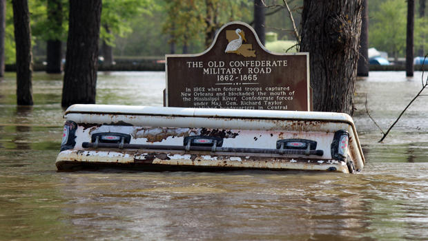
Katrina @ New Orleans killed more than 1800 people.
https://www.washingtonpost.com/news...slam-east-texas-as-major-hurricane-and-stall/
Rapidly strengthening Harvey forecast to slam East Texas as major hurricane
By Brian McNoldy and Jason Samenow August 24 at 12:50 PM
Harvey, at 10:15 a.m. eastern Thursday morning. (NOAA)
(This story, originally published at 11:05 a.m., was updated at 12:50 p.m. to include new forecast information.)
Tropical Storm Harvey is rapidly intensifying in the central Gulf of Mexico and is predicted to plow into east Texas as a very serious hurricane late Friday.
An incredible amount of rain, exceeding 20 inches in some areas, is likely as the storm is predicted to stall and unload torrential downpours for four to six straight days.
“Trying not to be dramatic, but I fear epic flood catastrophe,” tweeted Marshall Shepherd, a former president of the American Meteorological Society.
GFS model storm projection Friday night through Wednesday night. (PivotalWeather.com)
Not only are the rain and flooding concerns huge, but the storm also has the potential to generate destructive winds and a devastating storm surge — or raise the water above normally dry land at the coast.
Because it is positioned over extremely warm waters and strengthening so fast, Harvey may become the first major hurricane landfall, rated Category 3 or higher (on the 1-5 Saffir-Simpson intensity scale) to strike U.S. soil in 12 years. This is now the official forecast of the National Hurricane Center, which predicts the storm to make landfall as a Category 3 storm with 115 mph winds.
“Harvey has intensified quickly this morning, and is now forecast to be a major hurricane at landfall, bringing life-threatening storm surge, rainfall, and wind hazards to portions of the Texas coast,” the Hurricane Center said in its 11 a.m. discussion.
On Wednesday, Texas Gov. Greg Abbott declared a state of emergency in anticipation of the storm in 30 counties. Evacuation orders may come for some coastal areas Thursday.
At 11 a.m., Tropical Storm Harvey had 65 mph peak winds and was centered about 365 miles south-southeast of Corpus Christi. It is tracking toward the north-northwest at 10 mph and is expected to become a hurricane shortly.
Hurricane, storm surge and flood warnings plastered coastal and inland portions of east Texas on Thursday morning, and tropical-storm-force winds are forecast to reach the Texas coastline Friday morning.
(National Hurricane Center)
The general computer model consensus is that Harvey will make landfall Friday night between Port Mansfield and San Luis Pass, Tex., the zone under a hurricane warning. The biggest population center in this area is Corpus Christi — which may end up very close to the landfall location.
The five-day “cone of uncertainty,” an illustration of where the storm may track, is squashed down to a circle, indicating that after coming ashore, the storm may stall, unleashing its wrath over the same general area through at least Monday or Tuesday.
(National Hurricane Center)
The rain and wind from the storm could have profound effects on oil refineries near its path.
Texas has not been hit by a hurricane since 2008, when Ike crashed ashore near Galveston. Harvey could be a storm Texans remember for many years to come.
The rain
The rain forecasts are truly ominous. “Somebody is going to get a rainstorm to tell their grandkids about,” said Bill Read, a former director of the National Hurricane Center.
Areas from the Texas-Louisiana border up to Corpus Christi may see 12 to 20 inches of rain, with some locations seeing well over two feet. A few models forecast up to four feet of rain in isolated locations, so the potential exists for a flood event of historic proportions. But it is impossible to pinpoint exactly where the heaviest rain will fall.
https://img.washingtonpost.com/wp-apps/imrs.php?src=https://img.washingtonpost.com/blogs/capital-weather-gang/files/2017/08/rbtop0-4.gif&w=720[/video]
Seven-day cumulative rainfall forecast. (NOAA/WPC)
Houston, the nation’s fourth-largest city, could receive 10 to 20 inches of rain from the storm, depending on exactly where it tracks — with the heaviest moving in Saturday or Sunday and then continuing into early next week. Matt Lanza, a meteorologist based in Houston, said 20 inches would be “devastating” for the city, depending where it fell. A worst-case scenario, Lanza said, would be for this amount of rain to fall just northwest of downtown as “all that water has to push through the Bayou networks across the city into Galveston Bay.”
GFS model rainfall forecast through Thursday morning. (PivotalWeather.com)
Especially late this weekend and into early next, areas of western and southern Louisiana could also be hard hit with double digit rainfall totals.
Storm surge
The Hurricane Center predicts 6 to 10 feet of water — above normally dry land — inundating coastal areas immediately to the east and north of the landfall location. That amount is based on the assumption that Harvey makes landfall as a Category 3 hurricane. But the surge could be even higher (or lower) if the storm is stronger (or weaker) and will be adjusted as the forecast evolves. It is critical that affected residents heed evacuation orders.
Keep in mind that the timing of normal astronomical tides is a factor. If the highest storm surge arrives at or near high tide, the total “storm tide” will be maximized. As the timing of landfall is pinned down, forecasts of the storm tide timing and depth will be improved as well.
Wind
The official forecast is that Harvey will produce maximum sustained winds of 115 mph when it comes ashore, strong enough to cause widespread power outages and significant damage to homes and businesses.
Prototype #Harvey outage estimate model now being run. At website: [url]https://t.co/UMLPAXkJfE[/url] My colleague Steve Quiring (Ohio State) et al pic.twitter.com/PLJdGerEhn
— Marshall Shepherd (@DrShepherd2013) August 24, 2017
Uncertainties
The storm’s exact intensity is unfortunately a wild card at this point. Rapid intensification, which has begun, is a poorly understood and poorly modeled process. But, with absolutely ideal environmental conditions, there is reasonable possibility that Harvey becomes a major hurricane by landfall Friday. The last major hurricane to make landfall on the United States was Wilma in October 2005.
In addition to the uncertainty in the winds speeds, which has implications for how big the storm surge is, the other important uncertainties are the storm’s motion and duration, which have significant implications for where the heaviest rain falls and how long it lasts.
Right now, it is important for Texans in the path of this storm to understand — irrespective of where the storm makes landfall — Harvey’s footprint will be enormous because of its long duration. Preparations should begin immediately.
[video]https://img.washingtonpost.com/wp-apps/imrs.php?src=https://img.washingtonpost.com/blogs/capital-weather-gang/files/2017/08/gfs.prateptype_cat.us_sc.2017082412-loop-new.gif&w=660[/video]
[MEDIA=youtube]7wSART-jMY8[/MEDIA]
[MEDIA=youtube]WQYMku1RjqU[/MEDIA]